Petit Capucin : E face - Gervasutti route
Fusionner des documents
Attention, les photos associées ne seront pas supprimées et deviendront orphelines.
Si vous souhaitez juste modifier le titre ou les documents associés (ex : déplacer une sortie vers un autre itinéraire), il suffit de modifier le document.
Si ce document est un doublon comportant des photos, demandez @Modo_Topo_FR de fusionner les doublons pour déplacer les photos sur le document conservé.
Points de passage
Livres
Itinéraires
Images
Rapports incidents/accidents
Description
Approach
From the Torino Refuge, cross the Col des Flambeaux and enter the Combe Maudit, passing under the N face of the Tour Ronde.
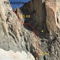
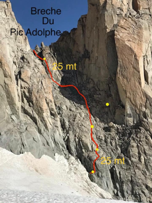
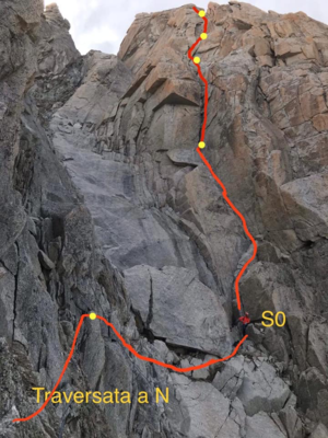
Once passed the majority of crevasses, approach the Petit Capucin and access the couloir to the right, next to the Pic Adolphe Rey. Climb this couloir to the breche (100m, very loose initially) then cross onto the N face and traverse steep, icy rocks for 50m to the start of the route. (45min to bergshrund, 1h-1h30 to the start of the route).
Route
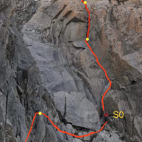
| L1 | 3b | Gain the chimney and follow it to a platform beneath a very steep chimney with chockstones (50m) |
| L2 | 5c | Climb the chimney (several pitons) to another platform and belay on the right (30m) |
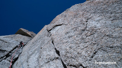
| L3 | 5a | Climb the buttress tending leftwards until you reach the base of a system of cracks (30m). Can belay here or continue another 20m up the cracks to a another belay. |
| L4 | 5a | Continue up the cracks to a corner on the right (30m). Climb the corner to a ledge (10m) |
| L5 | 4b | From the ledge, step up and right and follow a flakey groove up and to the left (50m) |
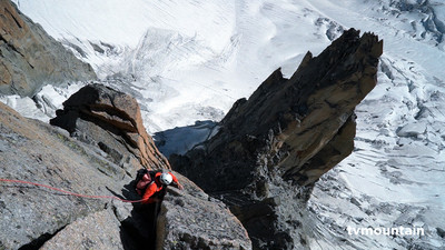
| L6-7 | 4b | Pick any one of a number of lines to the summit. (110m) |
Descent
From the summit, follow the ridge easily towards the Grand Capucin. 10m from the end, descend a blocky chimney to an abseil point. 7-8 abseils (2×50 m ropes) gain the glacier at the base of the Breche du Carabinier (watch out for falling rocks) (1h from summit)
Accès en transport en commun
Commentaires
Ce contenu est sous licence Creative Commons BY-SA 3.0
Les images associées à cette page sont disponibles sous la licence spécifiée sur le document d'origine de chaque image.
Imprimé le 9 octobre 2025 05:55

