Le Râteau - Sommet E : Loop Girose >> Râteau >> Meije via Enfetchores
Fusionner des documents
Attention, les photos associées ne seront pas supprimées et deviendront orphelines.
Si vous souhaitez juste modifier le titre ou les documents associés (ex : déplacer une sortie vers un autre itinéraire), il suffit de modifier le document.
Si ce document est un doublon comportant des photos, demandez @Modo_Topo_FR de fusionner les doublons pour déplacer les photos sur le document conservé.
Points de passage
Livres
Articles
Images
Rapports incidents/accidents
Description
To get to Vallon des Etançons, several solutions are possible. In two days from the La Grace tram, traverse Col de la Lauze (3512 m) and Col du Replat (3335 m) to sleep at the Chatellerêt refuge (2232 m). The route described here, which offers the most beautiful descent with the least HD and without car shuttle.
You can also reach this refuge from Bérarde (1713m) but this approach is tiresome in the winter because the road is closed beyond Champhorent (1598 m), which adds 7 km of slight slope (exposed to avalanches) to reach Bérarde and a car shuttle to return.
Another possible access with more HD but a very short shuttle: from Villard d'Arène(1667 m) via the passes of Chamois (3280 m) or Casse Déserte (3483 m). You can sleep at Pavé refuge (2841 m) and cross Col du Pavé (3554 m) to reach Vallon des Etançons at the altitude of 2900 m, under Promontoire refuge.
In one day from La Grave, take the first La Grave tram and traverse Col de la Girose (3514 m) or Col de la Lauze (3512 m) and the Brêche du Râteau (3235 m). Descend the eastern slope until Vallon des Etançons (2500 m) or, faster but more complex, traverse towards the north to the altitude of 3000 m to reach the Meije glacier, on the side above ravines and rock barriers.
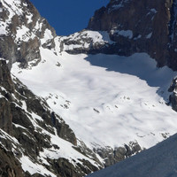
To reach Brêche de la Meije. From the Chatellerêt refuge, go up Vallon des Etançons towards the north, on the right bank of the moraine until the altitude of 2900 m, under Promontoire refuge. Turn to the left (northwest) to take foot on the Meije glacier (steep, crevasses) and go up it towards the north until the foot of the Brêche, on the right bank (west). Skis on the back-pack, climb 100 m of snow or vertical ice (45°).
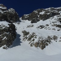
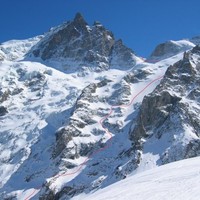
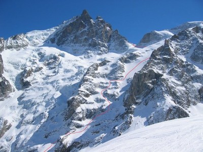
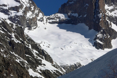
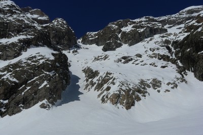
Descent via Enfetchores A the Brêche, place a rappel or a handrail safety rope (45 m) to descend the snow covered rocks and cross the bergschrund. Descend the broad slopes of the Meije glacier heading northwest. At the altitude of 3000 m penetrate the glacier arm which descends between the two rock ridges of Enfetchores. Leave it on the right bank (east) at the altitude of 2850 m to reach a system of northwest facing snow covered ledges, intersected with rock barriers. Be careful, this part is very exposed. A fall could be fatal, in particular on the last slopes of the Meije glacier (risk of sequence in ice), which dominates a serac fall. The slope varies between 30 and 35°.
Descend this system of ledges and of rock barriers as best as possible (complex zigzag route, hard to find) until the altitude of 2400 m. Then traverse again towards the west under the main part of the glacier and take foot on the moraine. From here it is easy to reach the classic route of Vallons de la Meije (right bank) around 2100 m. From there, depending on the snow cover, either stay on the right bank to reach La Grave via the Chal Vachère chalets (1844 m), or traverse towards the left (north) in the forest to the altitude of 2050 m to reach the first pylon (P1, 1720 m).
Remarques
Be careful, to do the loop in one day from La Grave you have to be in excellent shape and be very effective to keep to the schedule.
Large run-out glacier route. Exposed descent, not to be undertaken in hard snow or with a small amount of powder on the ice. Get information at the Bureau des Guides in La Grave before undertaking this descent.
Ascent faces south. Completely northern descent for experiencing powder.
Access:
La Grave via RN91 from Bourg d'Oisans or Briançon. Take then the La Meije tram.
Accommodation:
Numerous gites and hotels in la Grave and the surrounding villages (Les Fréaux, Villard d'Arène, les Hières, Ventelon, Le Chazelet).
Matériel
Crampons, ice axe, harness and crevasse rescue equipment, rope (rappel 90 m).
Accès en transport en commun
Itinéraires associés
Commentaires
Ce contenu est sous licence Creative Commons BY-SA 3.0
Les images associées à cette page sont disponibles sous la licence spécifiée sur le document d'origine de chaque image.
Imprimé le 11 août 2025 09:11

