Aiguille Large de Mary : Loop and summit
Fusionner des documents
Attention, les photos associées ne seront pas supprimées et deviendront orphelines.
Si vous souhaitez juste modifier le titre ou les documents associés (ex : déplacer une sortie vers un autre itinéraire), il suffit de modifier le document.
Si ce document est un doublon comportant des photos, demandez @Modo_Topo_FR de fusionner les doublons pour déplacer les photos sur le document conservé.
Points de passage
Articles
Rapports incidents/accidents
Description
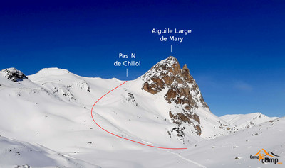
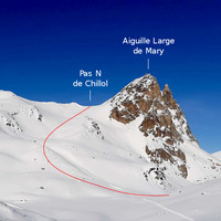
Climb: From the Maljasset refuge, traverse the Ubaye (point 1902m) then follow the cross-country ski tracks which lead to the opening of Vallon de Mary. Traverse the torrent (bridge) and continue in the field until a second small dale (road). Go up this road which ends on a flat area (point 2045m). Then go up the Vallon de Mary by skirting this side until the higher Bergeries de Mary (2380m -abri open). Go back to the left bank of the dale and traverse under the Marinet rocks in the direction of the spillway of the Lacs du Marinet (at the foot of Aiguille Large). Slightly before the lake go up on the right via a scoop until the N Pas of Chilliol. Climb the broad pinnacle on skis or on foot depending on the snow cover via the SW face.
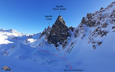
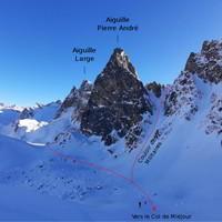
Descent: From the summit you reach the pass then descend under the Large pass via a pretty scoop which leads to the foot of Pierre André pinnacle. Traverse under the pinnacle while remaining as high as possible. You then pass under the N face to arrive at the foot of Col de Miéjour 2658m go up it (60m, feasible without putting skins back on). Then descend the Teste dale and the larch forest. You arrive at the hamlet of the Barge 1 km downhill from Maljasset that is reached via the cross-country ski tracks.
Variant: a descent variant involves descending by the Chilliol dale (PD +, S3). You arrive 3km downhill from the Barge on the Maljasset road.
Remarques
Gentle slopes for the climb, unrelenting for the descent.
Mainly in the larch forest where the slope reaches 30-35° in certain places.
Climb N then SE. First descent NE. Second descent NW.
Access:
Barcelonnette, Jaussiers, St-Paul via D990 then take D25 until Maljasset, Route de Maljasset is always open (sometimes closed a few days after a major snowfall) You can also take the Col de Vars road (D902) after Guillestre.
Accommodation:
Maljasset refuge 1902m, 60 places tel: 04 92 84 34 04. Attended all year. Caretaker: Philippe Lantelme.
Accès en transport en commun
Itinéraires associés


Commentaires
Ce contenu est sous licence Creative Commons BY-SA 3.0
Les images associées à cette page sont disponibles sous la licence spécifiée sur le document d'origine de chaque image.
Imprimé le 23 septembre 2025 00:43


