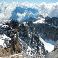
Hochalmspitze : E side, from Maltatal, Rudolstädter Weg
Fusionner des documents
Attention, les photos associées ne seront pas supprimées et deviendront orphelines.
Si vous souhaitez juste modifier le titre ou les documents associés (ex : déplacer une sortie vers un autre itinéraire), il suffit de modifier le document.
Si ce document est un doublon comportant des photos, demandez @Modo_Topo_FR de fusionner les doublons pour déplacer les photos sur le document conservé.
Points de passage
Livres
Itinéraires
Articles
Rapports incidents/accidents
Historique de l'itinéraire
First ascent : 1892 - A. Aschbacher, F. Kohlmayr, F. Kordon, M. Mayr, K. Stützl.
Description
Access
Gmünder Hütte (Malatatal), 1180m.
Approach
From Gmünder Hütte, take the path up to Villacher Hütte (description on that page).
Summer route
From the hut, follow the sign up the path, cross the bridge, and scramble up (red/white markings) in a general E direction. Reach the Hochalmkees (glacier) around 2700m, cross it by staying on its S side (left when going up) and reach the ridge between the Steinerne Mandln rock formation and the summit. Once on the ridge, follow it to the summit. Wide and easy at the start, gets narrower, steeper and exposed at the end. A few moves of climbing might be necessary, depending on the conditions.
Ski
Ascent
From the hut, cross the Langboden cliffs just south of the hut (there's a few passages), then head up E/SE, just N (left) of the Schwarze Schneid peaks. Once on the glacier (around 2700m) head up to the E, heading to the right (N) of Hochalmspizte. Once directly N of the summit, around 3200m, turn S and reach the ridge (small but obvious passage), and follow it to the ski summit at 3340m. Then on foot - crampons - for the last 20m (exposed) to the cross.
Descent
- Same way.
- Or steeper : go down more N on the glacier, just to the left of Preimlspitz, to reach the Preimlsee and from there down the Langboden to Villacher Hütte.
There is a possibility of going down directly from Villacher Hütte to the road at 1750m.
Remarques
It is possible to cycle (mountain bikes) up to ~1900m, it is a forest trail for tractors.

Commentaires
Ce contenu est sous licence Creative Commons BY-SA 3.0
Les images associées à cette page sont disponibles sous la licence spécifiée sur le document d'origine de chaque image.
Imprimé le 9 août 2025 12:09

