Aiguille d'Argentière : Glacier du Milieu
Fusionner des documents
Attention, les photos associées ne seront pas supprimées et deviendront orphelines.
Si vous souhaitez juste modifier le titre ou les documents associés (ex : déplacer une sortie vers un autre itinéraire), il suffit de modifier le document.
Si ce document est un doublon comportant des photos, demandez @Modo_Topo_FR de fusionner les doublons pour déplacer les photos sur le document conservé.
Points de passage
Livres
Itinéraires
Articles
Images
Rapports incidents/accidents
Historique de l'itinéraire
- 1st descent : 14th August 1880 - Lionel Dècle, J. A. Hutchison with mountain guides Abraham Imseng and Laurent Lanier.
- 1st ascent : 17th July 1895 - Fançois Biselx (mountain guide), Victor Attinger, Auguste Dubois, Maurice Joris (mountain guide).
Description

This is primarily a description for skiers but can be used for people on foot
Day 1 approach to the Argentière hut (2771 m)
From the summit of Grands Montets (3233 m), descend on Rognons glacier by following the piste until the altitude of approximately 3100 m. Then leave the piste in the direction of the rocky rognon at spot elevation 3000 m on the map. Take the slope just to its right. Continue descending, primarily to the NE towards Point 2754 m (Moraine des Rognons). Traverse to the right (SE) for 200 meters to reach a slope (NE) which leads easily onto the Argentière glacier (2580 m). Go up Argentière glacier by first remaining on its true left bank (careful, the true right bank is often heavily crevassed and difficult in bad weather.) At about 2650m, traverse diagonally across the glacier, heading towards the refuge. You reach it on the left by avoiding the obvious moraine and its rocky base. (It takes 1h30)
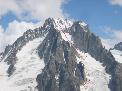
Day 2 Aiguille d'Argentière (390 0m) route, 8h to ascend and descend from the hut
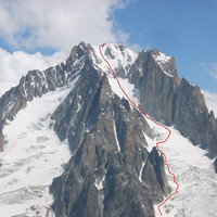
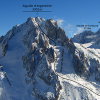
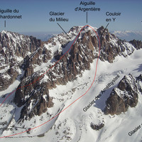
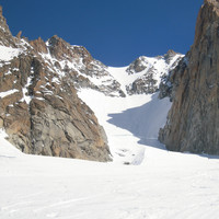
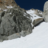
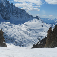
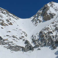
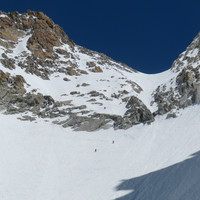
Climb directly diagonally (NW) towards the base of the Milieu, (depending on the snow cover, you might have to take off your skis) to reach the true right bank of the glacier (steep slopes -S3). Go up the Glacier while remaining on its right bank up to approximately 3350 m. Then traverse it to reach its true left bank under "Le Casque" then climb towards the bergschrund that is crossed primarily on the right bank of the glacier. The slope then becomes steeper (35 then 40° -skis on the bag) and steepens gradually until a gully where it becomes narrower (45° -rocks). The slope gradually eases, reaching the summit crest located between the western summit and the principal summit. Descend by the same route until Argentière glacier. Traverse it to reach its left bank and the ascent route. Follow this bank and pass under Moraine des Rognons. Around 2550 meters, a break in the glacier causes a more or less significant area of crevasses depending on the year. Remain on the extreme left side of the glacier to cross it. Follow the Glacier until around 2300 meters and leave it to reach Argentière ski area. You then reach Argentière via the ski lifts (Lognan intermediate station) or by the piste.
Remarques
- When the day remains cold, this route can be done in a day by taking the first Grands Montets cable car. It is useless to leave the refuge too early
- Above the bergschrund, the slope is steep (40°, a narrow section with rocks at almost 45°).
- Faces SW. Can take tome for the snow to soften for better ski conditions.
Matériel
- GPS and navigation instruments in the event of overcast weather.
Ressources externes
- Aiguille d'Argentière, Alpine Journal, vol. 10, 1881, no72, p.233 : chronicle of the 1st descent.
Accès en transport en commun

We didn't find any public transport stop point in a 5 km foot range from any route access point.
Itinéraires associés


Commentaires
Ce contenu est sous licence Creative Commons BY-SA 3.0
Les images associées à cette page sont disponibles sous la licence spécifiée sur le document d'origine de chaque image.
Imprimé le 29 juillet 2025 13:05

