Gros Châtillon : Normal route
Fusionner des documents
Attention, les photos associées ne seront pas supprimées et deviendront orphelines.
Si vous souhaitez juste modifier le titre ou les documents associés (ex : déplacer une sortie vers un autre itinéraire), il suffit de modifier le document.
Si ce document est un doublon comportant des photos, demandez @Modo_Topo_FR de fusionner les doublons pour déplacer les photos sur le document conservé.
Livres
Articles
Rapports incidents/accidents
Description
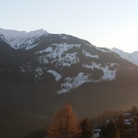
Scenic path, full of alps huts.

Ascent :
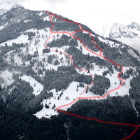
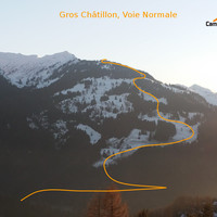
From Leoutre (carpark), take the forest road up to the end, or shorten up in the forest by the pedest path. From the alp hut in the end of the road (Colatel), go up through pastures and glades, to the south, until summit.
You can follow the crest until Croix de Javerne, but it is not better downskiing!
Remarques
- Nice sightseeing on the Rhoneriver.
- Easy and safe outing, especially by big avalanche danger or with beginners, with nice ski.
Accès en transport en commun

We didn't find any public transport stop point in a 5 km foot range from any route access point.
Itinéraires associés


Commentaires
Ce contenu est sous licence Creative Commons BY-SA 3.0
Les images associées à cette page sont disponibles sous la licence spécifiée sur le document d'origine de chaque image.
Imprimé le 28 juillet 2025 07:58


