Mont de Grange : Couloir de Pertuis
Fusionner des documents
Attention, les photos associées ne seront pas supprimées et deviendront orphelines.
Si vous souhaitez juste modifier le titre ou les documents associés (ex : déplacer une sortie vers un autre itinéraire), il suffit de modifier le document.
Si ce document est un doublon comportant des photos, demandez @Modo_Topo_FR de fusionner les doublons pour déplacer les photos sur le document conservé.
Livres
Itinéraires
Articles
Images
Rapports incidents/accidents
Description
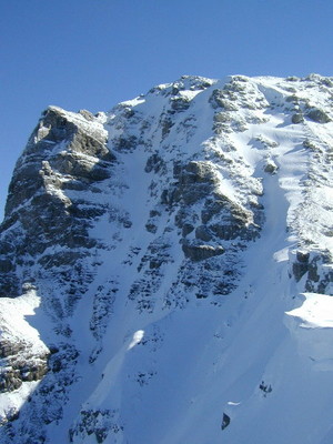
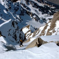
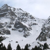
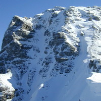
From the start of Crêt Béni chair lift (992m) you reach the summit of the ski lift of the Scoop (1571m) either by going up the tracks, or by taking the ski lifts. Then continue in the direction of the Pertuis chalets (1649m). Just before you reach the chalets, go up a small scoop towards the S, pass a ridge on the left to reach the broad Pertuis scoop. Go up it in the direction of the Bel-Air ridge. Shortly before arriving at the ridge, fork to the left and go up the boxed in Pertuis corridor. Two thirds up the corridor, you run into a junction giving access to three possible outings: -the one on right (while climbing), narrow and steep (S5) tops out a few metres to the W from the summit cross; -the one in the middle, also very difficult (S5), tops out between the two summits; -the left branch is less direct and slightly less difficult (S4/S5);
Descent by the same route. Under of Pertuis scoop, when it narrows it is more interesting to head for the small scoop mentioned above (small possible 20m ascent) than to descend until the Pertuis chalets.
Note: in the event of bad conditions in the corridor, it is possible to descend the W face until Belair ridge then via the north slope of the ridge reach the Pertuis scoop via the small Pertuis corridor (S4).
Remarques
If you use the ski lifts, the start is at 1571m, reducing the ascent HD to 860m. At the beginning or end of the season, you can drive to 1400m, slightly above Chable de la Plagne (start of the 4×4 road for the Pertuis chalets).
42°/400m, the last 100 meters almost reaching 50°. The corridor is rather tortuous and narrow towards the top out, with a rather strong exposure. D+/S5 or 5.1/E2 to E3.
The corridor is W to NW but boxed in. The Pertuis scoop is NW. Consequently the route remains rather well snow covered until late in the season.
Access:
From Thonon, head towards Abondance (D22) and continue to La Chapelle d'Abondance. Slightly before arriving in the town, turn to the right at the church to reach the Crêt Béni parking lot. From Switzerland, pass the Pas de Morgins to reach Chatel then Chapelle d'Abondance (towards Abondance).
Matériel
Ice axe/crampons
Accès en transport en commun
Arrêt : Chapelle d'Abondance Église (La Chapelle-d'Abondance)
Distance avec le point d'arrêt du topo : 0.66 km
Voir le détail des lignes
Arrêt : Office du Tourisme (La Chapelle-d'Abondance)
Distance avec le point d'arrêt du topo : 0.96 km
Voir le détail des lignes
Arrêt : Fruitière (La Chapelle-d'Abondance)
Distance avec le point d'arrêt du topo : 1.33 km
Voir le détail des lignes
Arrêt : Les Plagnes (La Chapelle-d'Abondance)
Distance avec le point d'arrêt du topo : 1.67 km
Voir le détail des lignes
Arrêt : Miolène (Abondance)
Distance avec le point d'arrêt du topo : 2.23 km
Voir le détail des lignes


Commentaires
Ce contenu est sous licence Creative Commons BY-SA 3.0
Les images associées à cette page sont disponibles sous la licence spécifiée sur le document d'origine de chaque image.
Imprimé le 13 août 2025 13:10


