Pointe de la Croix : from Arpy
Fusionner des documents
Attention, les photos associées ne seront pas supprimées et deviendront orphelines.
Si vous souhaitez juste modifier le titre ou les documents associés (ex : déplacer une sortie vers un autre itinéraire), il suffit de modifier le document.
Si ce document est un doublon comportant des photos, demandez @Modo_Topo_FR de fusionner les doublons pour déplacer les photos sur le document conservé.
Livres
Itinéraires
Rapports incidents/accidents
Description
Approach

From the MB tunnel take the old road past Courmayeur and St Didier to Morgex. From Morgex take the road across the river direction La Thuile via the Col San Carlo, (often kept open in winter despite its 1951m,) After a lot of hairpins you arrive at the little hamlet of Arpy 1670m, Turn off into the village where there is parking near the Nordic ski centre, (cafe).
Ascent
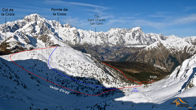
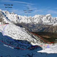
From Arpy 1670m follow the Nordic ski piste to you arrive at an old mine on the left and a bridge with a Nordic piste track leading across a bridge on the right. Cross the bridge and follow the piste for about 50m until there is a forest track leading off on the right, circa 1760m. (if you go to far to the end of the Nordic pistes, cross the last bridge and bushwack upwards on the true right bank of the stream to join the forest path upon the left, summer footpath with red and white markings on the trees.) At about 1850m cross to the true left bank, go up through trees passing a little building and then up more steeply to join the forest road coming in from the San Carlo col. This leads up to the Arpy lake. From the lake go towards the Col de la Croix, (footpath signposts) and before reaching this col, go to the right to the Point de la Croix (2478).
Descent
By the same route but with lots of possibilities as far as the Arpy lake. After the lake there is a small steep section to traverse.
It is also possible to continue NE from the summit to find a way into a nice slope leading down to where the Col San Carlo road meets the ascent path. Steeper skiing than the ascent route option.
Remarques
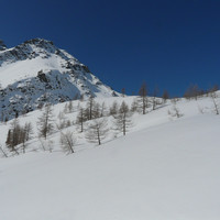
A lovely non-technical tour in superb surroundings. From March the route is in the sun.
Matériel


Commentaires
Ce contenu est sous licence Creative Commons BY-SA 3.0
Les images associées à cette page sont disponibles sous la licence spécifiée sur le document d'origine de chaque image.
Imprimé le 11 août 2025 15:52


