Camptocamp.org Topoguide
Sorties
Forum Incidents et accidents Articles YETI
Contact • CGU • Licences
Camptocamp Association • Cookies
Aide
Adhérer
Ajouter une sortie
Ajouter un itinéraire Ajouter un point de passage Ajouter un article Ajouter un livre Ajouter un rapport d'incident/accident
Se connecter  
Français Italiano Deutsch English Español Català Euskara Magyar 简体中文 Slovenščina

Appel aux dons 2025 : soutenez Camptocamp !

    Grépon : Charmoz-Grépon traverse

    Faites glisser des images ici ou cliquez pour les sélectionner Ces images seront diffusées sous licence Creative Commons. Si vous n'êtes pas l'auteur de l'image, vous ne pouvez pas la téléverser, à moins que l'auteur n'ait donné son accord pour qu'elle soit diffusée sous la licence Creative-Commons correspondante. Les images de plus de 2Mo sont redimensionnées par le navigateur avant d'être envoyées.
      France Haute-Savoie Mont-Blanc
    Fond de carte
    OpenTopoMap
    ESRI Sat
    IGN
    IGN Sat
    SwissTopo
    SwissTopo Sat
    IGN
    IGN Sat
    ICGC
    ICGC Sat
    basemap.at
    basemap.at Sat
    Ordn. Survey
    Cartes de pentes
    IGN
    SwissTopo
    Zones de protection
    Faune
    Fermer
    Chargement en cours…
      Zone sensible :

      Plus d'information | KML
      Zone sensible :
      Points de passage
      Grépon
      3482 m
      Grands Charmoz
      3445 m
      Refuge du Plan de l'Aiguille
      2207 m
      Téléphérique de l'Aiguille du Midi
      3776 m

      Livres
      Le massif du Mont-Blanc - Les 100 plus belles courses
      Chemins du Ciel - Les plus belles courses d'arêtes des Alpes
      Sommets du Mont-Blanc - Les plus belles courses de F à D
      La Chaîne Du Mont-Blanc, sélection de voies. Tome 1, A L'Ouest Du Col Du Géant
      Le topo du massif du Mont Blanc - Tome 1
      La chaîne du Mont Blanc, Guide Vallot : II - Aiguilles de Chamonix
      Montagnes Magazine #344
      Montagnes Magazine #392
      Montagnes Magazine #308

      Articles
      Liste de courses pour le probatoire d'Aspirant Guide en France - 2024
      Less difficult alpine routes in the Mont Blanc region

      Voir dans une autre langue
      français espagnol
      Prévisions météo (meteoblue) À proximité de...
      Qualité du document excellent
      Modifier le document
      Modifier les associations
      Versions
      Traduire
      Signaler un problème
      CC BY SA 3.0
      Ce contenu est sous licence Creative Commons BY-SA 3.0

      Fusionner des documents

      Attention : cette action est irréversible !
      Fusionner un document source avec un document cible transfère toutes les associations du document source au document cible, et définit une redirection du document source vers le document cible.   Les commentaires doivent être transférés manuellement dans Discourse avant de fusionner les documents.
      Document à fusionner (source) :
      Grépon : Charmoz-Grépon traverse ( 54627 )
      Document à conserver (cible) :

      Supprimer ce document

      Attention : cette action est irréversible !
      Êtes-vous sûr(e) de vouloir supprimer ce document ?
      Attention, les photos associées ne seront pas supprimées et deviendront orphelines.
      Si vous souhaitez juste modifier le titre ou les documents associés (ex : déplacer une sortie vers un autre itinéraire), il suffit de modifier le document.
      Si ce document est un doublon comportant des photos, demandez @Modo_Topo_FR de fusionner les doublons pour déplacer les photos sur le document conservé.

      Supprimer cette version linguistique

      Attention : cette action est irréversible !
      Êtes-vous sûr(e) de vouloir supprimer cette version linguistique ?
      Créer la première version du document dans la langue suivante
      Italien
      Allemand
      Catalan
      Basque
      Slovène
      Chinois

      Points de passage

        Grands Charmoz, 3445 m
        Grépon, 3482 m
        Refuge du Plan de l'Aiguille, 2207 m
        Téléphérique de l'Aiguille du Midi, 3776 m

      Livres

      Chemins du Ciel - Les plus belles courses d'arêtes des Alpes, Mario Colonel
      La chaîne du Mont Blanc, Guide Vallot : II - Aiguilles de Chamonix, Lucien Devies, Pierre Henry, Jacques Lagarde
      La Chaîne Du Mont-Blanc, sélection de voies. Tome 1, A L'Ouest Du Col Du Géant, François Labande
      Le massif du Mont-Blanc - Les 100 plus belles courses, Gaston Rébuffat
      Le topo du massif du Mont Blanc - Tome 1, Michel Piola
      Montagnes Magazine #308,
      Montagnes Magazine #344,
      Montagnes Magazine #392,
      Sommets du Mont-Blanc - Les plus belles courses de F à D, Jean-Louis Laroche, Florence Lelong

      Itinéraires

      Grands Charmoz : Traversée 400 m, AD 4b III P3  •  Mont-Blanc

      Articles

      Less difficult alpine routes in the Mont Blanc region
      Liste de courses pour le probatoire d'Aspirant Guide en France - 2024

      Images

      Charmoz
      Charmoz
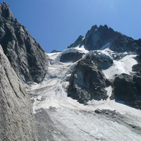
      Glacier des Nantillons
      Glacier des Nantillons
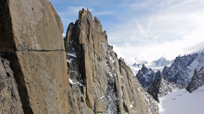
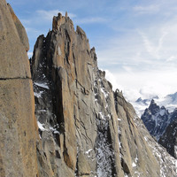
      Grépon
      Grépon
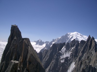
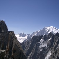
      Le Grépon et Le Mt-Blanc depuis le début de l'arête
      Le Grépon et Le Mt-Blanc depuis le début de l'arêt…
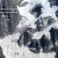
      Nouvelle descente des Nantillons août 2014
      Nouvelle descente des Nantillons août 2014
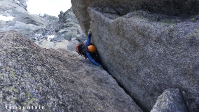
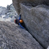
      Traversée Charmoz-Grépon. Aiguilles de Chamonix Mont-Blanc. Montée aux Grands Charmoz.
      Traversée Charmoz-Grépon. Aiguilles de Chamonix Mo…
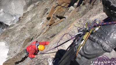
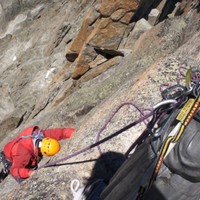
      Traversée Charmoz-Grépon. Aiguilles de Chamonix Mont-Blanc. Sous la Vierge du Grépon.
      Traversée Charmoz-Grépon. Aiguilles de Chamonix Mo…

      Rapports incidents/accidents

      Activités
      Type d'itinéraire boucle (pied de la voie)
      Durée 1   jour(s)
      Type de rocher granit
      Configuration arête
      Cotations
      D 5c>4b III P3
      D
      Cotation globale
      5c
      Cotation libre
      4b
      Cotation obligatoire
      III
      Engagement
      P3
      Qualité de l'équipement
      Matériel glacier matériel de sécurité sur glacier
      E W S N
      Altitude 2205 m / 3482 m
      Dénivelé +1300 m / -1300 m
      Dénivelé des difficultés 400   m
      Altitude du début des difficultés 3080   m

      A route with many facets, complicated glacier approach, route finding on the W face of the of the Grands Charmoz and an exposed and aesthetic ridge.

      Historique de l'itinéraire

      • 1st traverse of Grands Charmoz (NW-SE) : September 10, 1887 - P. Burnet, T.P.H. Jose, François Simond.
      • 1st traverse of Grépon (N-S) : August 18, 1892 - John Norman Collie, Geoffrey Hastings, Albert Frederick Mummery, Charles Henry Pasteur.

      Description

      Approach 3h30

      From the Plan d’Aiguille cable car station, follow the path which traverses the Blaitière glacier and leads to the Nantillons glacier, following various cairns.
      Variant: If you are coming form the Midi Plan hut it is best to take the lower path directly E from the hut, and finish up the moraine of the Nantillons glacier to its high point.

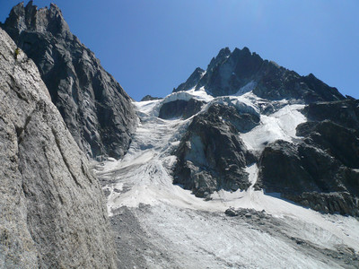
      Cross to the true right bank of the glacier (risk of stonefall, cross low down and quickly!) arc upwards and go to the right to reach the Rognon des Nantillons (at the first 1/3 of the Rognon), where the glacier levels against it, at the foot of some seracs.
      Climb to the top of the Rognon, firstly by easy steps on the far right, then less to the right, (cairns,) where the angle eases, then go back to the left on a vague ridge.
      From there go up the glacier to the left, (serac risk), until the bergshrund of the Grands Charmoz, pass it as best you can to gain the terraces on the true right bank of the Charmoz-Grépon couloir.

      Route 6 to 10h

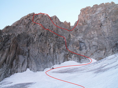
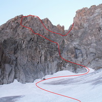
      From the foot of the couloir to the gap 3421m 2h

      Climb to the left of this couloir for about 200m until large terraces which you follow to the left, (obvious large cairn.) Traverse leftwards at about the level of a red tower.
      You come to a series of chimneys and corners to the right of a red spur. Climb this line, 4c max, including the Burgener crack, which is often verglaced.

      From the gap to the summit of the Charmoz-Grépon couloir 2h

      Start the ridge by turning the first pinnacle on the Nantillons side (4c, 2 pegs).
      Follow the crest of the ridge, (3b, exposed,) and reach the next gap by a short and delicate down climb on the Mer de Glace side.
      Bypass the third pinnacle (La Carrée) again on the Nantillons side, firstly on a large flake then by slabs to reach after a pull-up a platform under a thin pinnacle the “Bâton Wicks” (4c).
      A short abseil leads to the next gap. Follow the tapered ridge for several metres to reach another abseil, which you need to pendule to reach a platform of boulders (15m). From here you can climb to the highest point (4b).
      Descend by easy but bad rock to the top of the Charmoz-Grépon couloir.

      From the top of the couloir to the summit of the Grépon 2 to 3h

      Do not go to the lowest gap, (in the line of the couloir) : climb a corner, "the open book" (4b, 2 pegs,) which leads to the gap to the right of col Charmoz-Grépon. Go onto the Mer de Glace side, traverse for 20m then climb back up to another gap at mid height of the Mummery crack.
      You reach the crack either by a short but delicate traverse, (5c, 2 pegs, steep slab) or by climbing down 4 metres and then traversing (4c, slab).
      Climb the remaining 10 metres, tricky for 3m, (5b).
      Go back onto the Mer de Glace side by the "Trou du Canon", climb a crack capped by an overhang, (4b,) to the left, and pass back onto Nantillons side through a slot (“letter box”.) Hand traverse the flakes on the ridge, (4c,) then follow the sharp ridge, (2 pegs high up, the start of the flake traverse is a bit committing.)
      A first abseil leads to a gap from where you climb the next pinnacle (3c.) From there, abseil down the Nantilons side to a ledge which you follow to the next gap. A narrow ledge on the Nantillons side then a long stride after having gone over to Mer de Glace side, brings you to the "Vire à Bicyclette”, (cycling ledge). Follow this to its end. By another flake, hand traverse on the right, (easier than the one before,) to reach a delicate, Z shaped crack, (1 move of 4c, protectable with nuts,) on the Nantillons side., which you climb to the summit and the statue of the Virgin.

      Descent to the Col des Nantillons 1h

      From the summit make an abseil of 20m on the Mer de Glace side to reach the Balfour gap. From there, in two abseils of 25m, reach an obvious shoulder, from where a 30m abseil leads to a deep gap. Climb back up the little wall opposite of 3m, (3c,) without releasing the rope, which gives access to a terrace.
      At the end of the terrace down climb the shoulder and ledges, leading to near the Col des Nantillons.

      Return to the Start of the Route 1h
      Go onto the glacier, and join the approach route near the Charmoz bergschrund, by going from left to right.

      An alternative is, depending on the state of the glacier, to go to the true right side of the glacier and descend a ramp of broken rocks a long the base of the Grepon. An abseil of 25/30m, good belay, (pegs and slings,) brings you to within a few metres of the start of the route. Return to Plan d’Aiguille by the approach route.

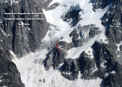
      It is also possible to abseil from the summit of the Grepon all the way to the ramp, (Recommended at the end of season or if the glacier is particularly dry.) After the first two abseils of 25m identify an ovbvious boulder at the end of a terrace (2 bolts.) From here a series of abseils, always with new bolts, leads down to the middle of the ramp. Careful 50m abseils unavoidable.

      Remarques

      About 400m of height gain from the bergschrund to the Summit of the Grepon, however the distance along the ridge is considerable. A long route!

      Matériel

      Crampons and 1 ice axe each, particularly for the descent of the col des Nantillons ;
      Slings, nuts and friends ;
      Rope : 60m advisable, 2×50 m if you take the new abseil line.

      • Alpinisme neige/glace/mixte de F à PD+

      Itinéraires associés

      Grands Charmoz : Traversée 400 m, W, AD 4b III P3
      Le Grépon et Le Mt-Blanc depuis le début de l'arête Grépon Traversée Charmoz-Grépon. Aiguilles de Chamonix Mont-Blanc. Montée aux Grands Charmoz. Traversée Charmoz-Grépon. Aiguilles de Chamonix Mont-Blanc. Sous la Vierge du Grépon. Glacier des Nantillons Charmoz Nouvelle descente des Nantillons août 2014
      Dernières sorties
      2024-07-25  •  Grands Charmoz : Pilier Cordier + Traversée Charmoz-Grépon  •  Pilou Bergues  • 
      2023-07-23  •  Grépon : Traversée Charmoz - Grépon  •  PATTIER Pierre  • 
      2022-07-10  •  Grépon : Traversée Charmoz - Grépon  •  Timothée Billiet  • 
      2022-07-06  •  Grépon : Traversée Charmoz - Grépon  •  thomasrevest  • 
      2022-07-03  •  Grépon : Traversée Charmoz - Grépon avec bivouac  •  Martin  • 
      2022-07-02  •  Grépon : Traversée Charmoz - Grépon  •  polocham  • 
      2021-08-21  •  Grépon : Traversée Charmoz - Grépon et bivouac au sommet  •  AnnabelleB  • 
      2021-08-21  •  Grépon : Traversée Charmoz - Grépon  •  Alex Saunier  • 
      Voir tous les résultats 62 Ajouter une sortie

      Commentaires

      Se connecter pour poster un commentaire

      Ce contenu est sous licence Creative Commons BY-SA 3.0

      Les images associées à cette page sont disponibles sous la licence spécifiée sur le document d'origine de chaque image.

      Imprimé le 15 juin 2025 14:55

      Camptocamp.org

      Contrôlez l'utilisation de vos données personnelles

      Notre site Web utilise des cookies fournis par nous et par des tiers. Certains cookies sont nécessaires au fonctionnement du site Web, tandis que d'autres peuvent être ajustés par vous à tout moment, en particulier ceux qui nous permettent de comprendre les performances de notre site Web et de vous fournir des fonctionnalités de médias sociaux. Vous pouvez les accepter ou les refuser tous ou bien paramétrer vos choix.
      Paramétrage des cookies

      Cookies nécessaires

      Les cookies nécessaires sont indispensables au bon fonctionnement de notre site Web et ne peuvent pas être désactivés. Ils sont envoyés à votre ordinateur ou à votre appareil lorsque vous demandez une action ou un service spécifiques, par exemple lorsque vous vous connectez, remplissez un formulaire ou définissez vos préférences en matière de cookies. Si vous configurez votre navigateur de façon à bloquer ces cookies ou à vous avertir de l'existence de ces derniers, notre site Web ne fonctionnera pas intégralement.

      Cookies statistiques

      Grâce aux cookies statistiques ou analytiques, fournis par nous et d'autres sociétés, nous pouvons compter les visites sur notre site Web et connaître les sources de trafic. Les données que nous obtenons nous aident à comprendre ce que les visiteurs aiment et améliorer le site Web. Si vous ne les acceptez pas, nous ne pourrons pas améliorer votre expérience.

      Cookies sociaux

      Ces cookies permettent d’interagir depuis le site camptocamp.org avec les modules sociaux et de partager les contenus du site avec d’autres personnes ou de les informer de votre consultation ou opinion sur celui-ci, lorsque vous cliquez sur le module "Partager" par exemple. En désactivant ces cookies, vous ne pourrez plus partager les contenus de camptocamp.org depuis le site camptocamp.org sur les réseaux sociaux.